타지키스탄 판 마운틴 세븐레이크 지역 트레킹 2일차-7번째 호숫가 야영지에서 1번째 호수까지 하행 트레킹

이후 대중교통 연결을 워해 이지역의 중심 마을인 싱 마을까지 약 5킬로 정도 추가로 걷게됨

Hiking/Backpacking

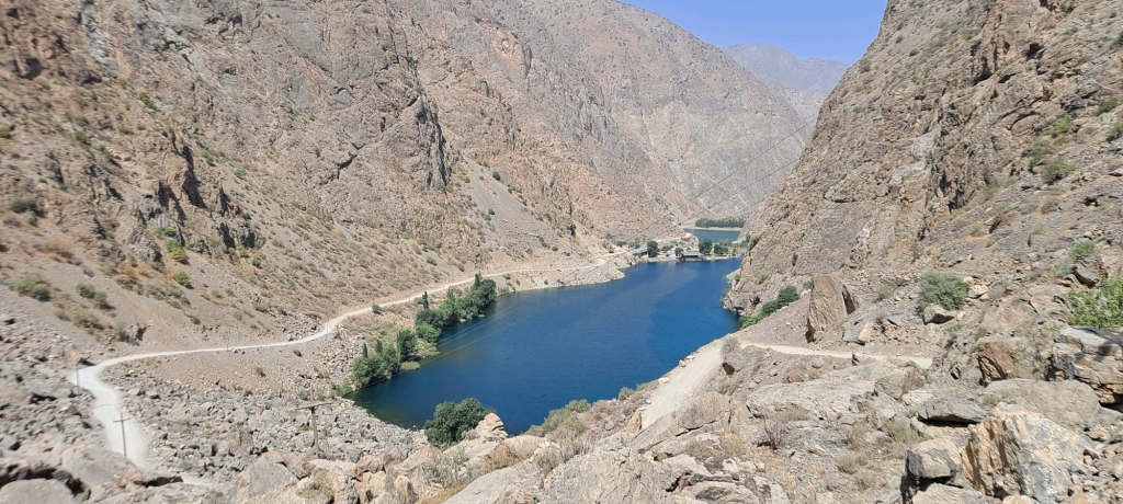
모든 트레일이 비포장도로라서 날리는 먼지가 고역인데 다행히 차량 통행이 적어서
Panjakent District, Sughd Region, Tajikistan
rainwind58 photo
time : Sep 2, 2025 6:19 AM
duration : 7h 18m 6s
distance : 25.3 km
total_ascent : 589 m
highest_point : 2367 m
avg_speed : 4.1 km/h
user_id : rainwind58
user_firstname :
user_lastname :
이후 대중교통 연결을 워해 이지역의 중심 마을인 싱 마을까지 약 5킬로 정도 추가로 걷게됨
Info
Name
 
About Me
Media Contents
  •  
  • -
  •  
  • -
  •  
  • -
  •  
  • -
Most Frequent Activity
1.
-
2.
-
3.
-
Widget
Copy the widget source code below and paste into your blog template.
 
( / )
  No more trips to show
 
No more trips to show
rainwind58's Collections
 
Sorry, the collection could not be found.
Bookmarked Collections
 
Sorry, the collection could not be found.
 
(0)
  There is no data
Blocked Users(0)
  There is no data
Ramblr passports
  Share

  Grab the URL link to the passport.

0 like(s)
 
(0 / 0)
Badges (0)
These are the badges you have acquired. Click to see the details.
     
     
    These are the badges you have acquired. Click to see the details.
    Badges acquired
      Full Screen
     
      Google Map
      Naver Map
    Statistics
    • Total
      Trips
      -
    • Total
      Distance
      -
    • Total
      Duration
      -
    • Highest
      Point
      -
    • Total
      Ascent
      -
    • Average
      Speed
      -
    Most Frequent Activity
    Click on the stat type above to see its graph.
  • First Certification Date :
  •  
    Following
      Follow
    Unfollow
  • 0
     
    There is no badge.
  • Draft
    Private
    Secret
     
    -
      Edit
      Delete
    Are you sure you want to delete this trip?
    YES, delete
    NO, cancel
    Add to Collection
     
     
    Create a Collection Edit Collection
     
    Name
     
    Description
     
    Visibility Setting
     
    Trip Sorting by
     
    Cover Picture